|
|||||
My conclusion is that the only reason to find Nothobranchius in ponds in the end of the rainy season is because of the lowest position of the ponds in the overall landscape and that Vertisol soils have nothing to do with Nothobranchius life cycle. Why we found them so often in Vertisol ponds?
Because the high content of clay in these soils prevents them from rapid oxidation (in clay soils, the process is very slow, possibly taking centuries, because it is difficult for air to circulate in the clay), which is essential for small water bodies, like temporary pools staying habitable.
Broad level or nearly flat areas of Vertisols often lack an integrated drainage network. In response to the fine-textured swelling soil, infiltration is slow (infiltration rates as low as 0.05 cm/hour are not uncommon) and in the rainy season water may stand on the surface for extended periods. More commonly, water flows slowly on the surface into mounds and depressions from which the water is slowly lost mainly by evaporation and, to a lesser extent drainage (Wilding et al., 1983). Mounds and depressions may be either round or linear. The depression could occur with a frequency of 2-100 m and to a depth of 10-100 cm, exceptionally up to 250 cm (Wilding et al., 1983). Once they have reached their field capacity, practically no water movement occurs. This is due to the very low hydraulic conductivity of Vertisols.
Where my doubts arise: vertisols form from a wide variety of parent material, but a common feature is a neutral to alkaline reaction (Buol et al, 2003). Many Vertisols have developed on parent materials of recent age such as marine, riverine, lacustrine and alluvial deposits, and on volcanic materials (Wilding et al.,1983), but most Vertisols are derived from Cenozoic materials. Some Vertisols are developed from much older bedrock materials. Even though the parent materials may have formed in older geological time periods, Vertisols have generally developed in recent times (Ahmad et al, 1996). Most Vertisols are Late Pleistocene and Holocene formations. The periods of alternation of dry and humid climate at the end of the Pleistocene and during the Holocene created favourable conditions for the formation of Vertisols.
According to Dorn et al, 2014, the estimate age of the Nothobranchius genus is 8.3 mya (Dorn et al, 2014). Sometime after 8 mya the spread of grasslands broke down the forest. However, it has been a long process and grasses have slowly made their way through the trees, with greater proportions of savannah grasslands peaking between 1.8 and 1.6 mya (DeMenocal, 2011). Time when grasslands began to dominate the ecosystem.
Prior to 2.6 mya the climate in East Africa was relatively stable and humid, and much of the region has been covered with large lakes that have come and gone. Many paleolakes like Manonga-Wembere formed under shallow conditions have dried out periodically as a result of ongoing rifting processes. Sedimentation, which continues today in lakes, deltas and ocean basins, was not unknown at this time. And then clay is formed by eroded particles washed up to these locations and compacted by settling. There is, however, a small but substantial detail. Emersions between the wet and dry phases were then so prolonged that oxidation turned any clay left out of the water into thick red beds of Ferralsols. Ferralsols are tropical and subtropical soils of old landscapes formed under broadleaf, evergreen vegetation and high rainfall conditions. Cleared of vegetation, these soils are easily eroded. Ferralsols have a high content of oxides of iron and aluminum. The red color in soils indicates that the particular soil is rich in iron oxides. As a result of igneous, metamorphic and pedogenic processes soils rich of iron covered by water form iron sulphide layers. While remain under the water iron sulfides are harmless, but exposed to air they generate acid and, in floods following dry periods, the sulfuric acid produced by oxidation of iron sulfides saturate the pond soil and water. The acid dissolves iron and aluminium from the soil and damage the environment severely. If fish and crustaceans fall into such an environment and can not escape, they die. Prior to 2.6 mya temporary water bodies did not offer the proper living and development conditions for the Nothobranchius. Permanent ponding without outlet leads to high water acidification due to the accumulation of large quantities of rotting organic matter, or we go to the other extreme where evaporation, only pure, clean, H2O leaves the system, all the other minerals and organics remain in the pool and the pH goes up and the environment becomes too salty even for Nothobranchius; while the availability of such outlets prevents the formation of Vertisol soils.
Vertisol soil properties such as clay content, soil structure and shrinking and swelling characteristics limit the vegetation to grasses and slow-growing deep-rooting tree species with hard wood (Wilding et al., 1983). Even that sometimes Vertisols have good water holding properties, these properties vary widely due to the complex pore space dynamics. A large proportion of all water in Vertisols, and notably the water held between the basic crystal units, is not available to plants (Driessen et al., 2001), respectively for the Nothobranchius eggs too.
The properties of Vertisols are a consequence of the high proportion of smectite in its composition. Smectite shows a peculiar crystal structure and while the interlayer space in other clays is very stable in smectite is loose, because the bond between sheets is done by very weak forces (Van der Waals forces). This makes easy the ingress of water into the interlayer space during the rainy season, but also make them easy to lose it during the dry season. The entry of water into the interlayer space makes the sheets to separate the crystal structure, evaporation reduce this space and soil contract.
In the course of the dry season Vertisol soils become extremely dry, form deep cracks (up to several meters deep) and often temperature of the hard surface crust reach 60 degress celsius (Jutzi et al., 1988).
Why the Vertisol ponds are traps?
Because of the way Vertisol soils being saturated with water. The rain induces rapid water flow into large cracks (Mitchell et al., 1993). Water move downward without being absorbed into the soil matrix (Bouma et al., 1978); Infiltration occurs in the subsoil matrix via the bottom of the cracks and along the crack faces, a process that has been named ‘internal catchment’ (Van Stiphout et al., 1987). An initial penetration is rapid, but may only continue for a short time as some of the Vertisols cracks can close quite rapidly (Elias et al., 2001). High intensity rainfall on dry, cracked soil induced rapid crack closure at the soil surface within few hours, mainly due to swelling of soil island borders, when most of the soil matrix was still unsaturated. It take up to 50 mm of rain to wet the top 100 mm of soil from a dry condition and to close the cracks at the surface. The cracks that remain under the surface providing the only route for movement of water downwards (Lathman et al., 1987). Infiltration is done through bypass flow. It is a vertical flow of free water along the walls of preferential flow paths down the soil profile. The solute and water circumvent the soil matrix and move down the soil profile before the upper soil layers are saturated (Bouma et al., 1981). Swelling starts at the bottom of soil cracks (Bouma and Loveday, 1988). This way fo saturation of Vertisol soils from bottom to the top do not leave any chance to the embryo to hatch in water if the egg is buried under the top layer. If the egg is deposited at the top layer (top 10 cm) it must be capable to survive extreme dryness and extreme temperatures.
The other way of infiltration known as Matrix flow that involves water movement from saturated upper to unsaturated lower layers of the soil profile (Nielsen et al., 1986) is leaching. Leaching promotes destruction of the smectites. If this happens the Vertisol properties diminish, resulting in the formation of other soils (Ahmad et al., 1996).
After the top soil layer is closed infiltration become very slow. Over the period of 5-24 hours, the average saturated hydraulic conductivity of Vertisols is 3-4 cm/day. For the period of 3-7 days, it had fallen to 0.5 cm/day (Gardner and Coughlan, 1982) and so on. The rates decline with time. By the middle of the rainy season the soil has usually swelled sufficiently to close the cracks (Lathman et al., 1987). For example, 450 mm rain close 50 cm crack. Annual rainfall in the interior of Tanzania where many Nothobranchius species occur is 400-800 mm.
The statement that Vertisols are the only soils that can provide all necessary conditions for Nothobranchius to complete their life cycle (Wildekamp, 2004; Reichard et al., 2010) are in contrast to Nothobranchius occurence in places where these soils absent even as inclusions, such as Rufiji Coastal Floodplains and Kilombero Valley (Veldkamp, 2001). Rufiji Coastal Floodplains - poorly drained young alluvial Fluvisols developed in riverine floodplains where the following species are found
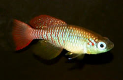 ANC Nothobranchius annectens |
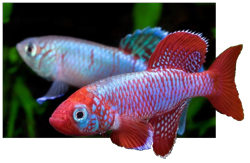 EGG Nothobranchius eggersi |
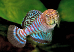 FSC Nothobranchius fuscotaeniatus |
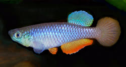 JAN Nothobranchius janpapi |
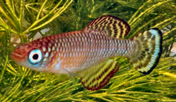 LOR Nothobranchius lourensi |
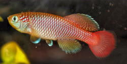 MEP Nothobranchius melanospilus |
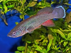 Nothobranchius ocellatus |
In the Kilombero Valley, poorly drained old alluvial (Eutric) Fluvisols developed in Pleistocene stream deposits, or poorly drained young alluvial Fluvisols developed from lavas and granites the following species are found.
 Nothobranchius geminus |
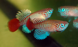 Nothobranchius kilomberoensis |
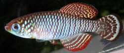 Nothobranchius lourensi |
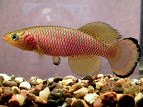 Nothobranchius lucius |
In the immediate vicinity of the streams and rivers where many Nothobranchius have been found, there are mainly young soils, like Fluvisols (from the Latin fluvius, meaning river). Vertisols form further from streams where the perturbation of flooding is less frequent (Retallack, 2001). In fact, Vertisol soils around the water basins are quite young and notably some 5000 years ago, when the climate became dryer again and the lake levels dropped, the rivers became intermittent and Vertisols could form in the alluvial deposits (Driessen et al., 2001).
It is well know that Vertisols cannot stand surface runoff and form typically in mounds and depressions. It rains from 8 to 12 weeks. For that time the whole plain is flooded. Nothobranchius reaches sexual maturity for less than 4 weeks (Turner, 1964). It is too naive to think that all these eggs laid somewhere in the plain between 4th and 12th week when Nothobranchius are young, active and prolific will not survive if they are not laid on Vertisol soils.
In terms of moisture holding capacity, the Vertisol soils are generally low due to the density of their subsoils (Veldkamp, 2001), which means they maintain the water level above the soil surface for a longer time, but when the water level drops to the soil level they dry very fast and in all other soils it is highly variable and depends on the nature and sequence of the sediments. The overall moisture holding capacity of the soil is a major factor for the survival of the egg because the soils with a high moisture holding capacity dries more slowly and give the egg time to adapt to the changing conditions. A slow transition (on the order of days) from wet to dry is often required for survival of anhydrobiosis and is thought to allow organisms time to make the biochemical adjustment (e.g., accumulation of trehalose) necessary for survival (Womersley et al., 1989). For example coarse-textured soils (loam soils) conserving soil moisture where moisture levels are not enough to meet the evaporative demands of the atmosphere. This is because of their low desorptivity and their ability to form dry surface mulch which acts as a barrier to evaporation (Amooh et al., 2015).
That's why I'm not surprised that all attempts in Kruger National Park from 1975-1985 to translocate Nothobranchius from one Vertisol pond to another failed (Reichard et al., 2010). Because all atempts are made to translocate fish to places that do not offer proper conditions for egg survival. In a few rare cases the translocated populations were able to survive through a seasonal cycle was because the translocations occurred during a particularly wet period. Or when fish received chance for a short time to breed out of the traps (Vertisol ponds). Vanderplank made the same mistake.
Actually, Vertisol ponds are places where Nothobranchius being trapped in the end of the rainy season due to properties of the Vertisol soils to hold water above surface level for a longer time - this benefit fishes prolonging their life span, but do not work in favour of the eggs.
In Sudan and South Sudan, Vertisols occur mainly on the western, central and eastern clay plains. They cover an area of approximately 500 000 km, or 50 million hectares. In all tropics total extent of Vertisols has been estimated at 250 million hectares (Dudal, 1965). If the Vertisol soils were really important to the Nothobranchius, Sudan and South Sudan had to be Nothobranchius paradise. Actually, 4 from the 6 valid Nothobranchius species collected in Sudan - Nothobranchius virgatus, Nothobranchius rubroreticulstus, Nothobranchius bellemansi and Nothobranchius nubaensis are found in channels with moving water - conditions that prevent formation of Vertisols (see pictures).


